Welcome to an exciting journey around the world! We are pleased to present a printable activity that invites elementary students to embark on a colourful exploration of our planet's seven continents. Through colouring and simple graphing, students will not only enhance their geographical knowledge but also develop essential skills in data representation and analysis.
It is crucial to teach children about the continents in their early geography education. This lays the groundwork for their comprehension of worldwide diversity, cultures, and environments. To make learning about the continents more engaging and enjoyable, this activity offers a hands-on approach that allows students to learn in a fun and interactive way.
Let's get started!
Printable & Activity Objectives
💡
Age: 7 to 9 year olds, Activity Time: 1-2 hours, Items Needed: Colouring and writing pencils
In this creative printable activity, students will colour continents and graph population sizes to improve recognition, data interpretation, and global awareness.
It will help your child or student with:
Geographical Knowledge: Students will gain a thorough understanding of the locations of the seven continents on a world map.
Data Interpretation: As students read and interpret the information presented on the population graph, they will develop basic data interpretation skills.
Global Awareness: This activity promotes global awareness and encourages students to think beyond their immediate surroundings.
Cross-Curricular Integration: Teachers can integrate this activity with other subjects such as social studies, mathematics (graphing), and art, promoting interdisciplinary learning.
Let's begin!
Classroom Resources
Simple steps to start:
Research and learn more about the seven different continents. Here's a great introduction video about the seven continents of the world and its diversity:
Here's a very interesting video about the inaccuracies and difficulties of representing the 7 continents on a map:
Get started on the printable worksheet!
Share this Teaching Resource
What's in the Printable Worksheet Pack
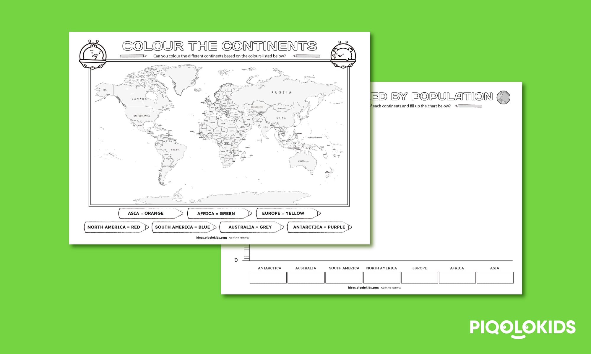
This printable activity pack consists of 2 creative printable worksheets. Here's what it consists of:
1 Printable Continents Colouring World Map Sheet
1 Printable Continents Population Size Graph Charting Sheet
BUY INDIVIDUAL PRINTABLE PACK (PDF ONLY)
Purchase this printable pack individually OR SUBSCRIBE to our PREMIUM PLAN for unlimited access to all premium printables and AI Tools.